

.png)
Data-Driven Diplomacy - Geological Survey of Iran (GSI) on the Way of Technological Cooperation with BRICS Countries.
The Islamic Republic of Iran, using the scientific and technological capabilities of its Geological Survey, has taken important steps in the development of spatial technologies and data governance in cooperation with BRICS countries. In this direction, Iran's national infrastructure of spatial data and mineral exploration, as the main axis of international interactions, plays a key role in advancing joint technology projects and intelligent usage of spatial data.
The Islamic Republic of Iran, using the scientific and technological capabilities of its Geological Survey, has taken important steps in the development of spatial technologies and data governance in cooperation with BRICS countries. In this direction, Iran's national infrastructure of spatial data and mineral exploration, as the main axis of international interactions, plays a key role in advancing joint technology projects and intelligent usage of spatial data.
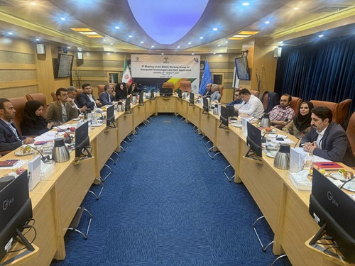
At the expert meeting of the BRICS Spatial Technologies Working Group hosted online by the Iranian Presidential Center for Transformation and Progress, Iranian representatives including Dr. Farnoosh Farjandi, Acting Head of the Geomatics Office, and Dr. Reza Ghasemi, Acting Head of the National Geosciences Database from the Geological Survey of Iran, outlined the country's achievements in the field of artificial intelligence, spatial data, and mineral exploration.
Iran, by introducing its advanced spatial data infrastructure and mining capacities, announced its full readiness to participate in international projects, create joint spatial databases, and form specialized artificial intelligence consortia.
This meeting reflects Iran's strategic approach to strengthening data governance and developing spatial technologies, which, in cooperation with key BRICS countries such as Russia, China, India, Brazil, Indonesia, and South Africa, can greatly contribute to improving crisis management, sustainable development, and future planning.
The Geological Survey of Iran, utilizing modern technologies of remote sensing, mapping, and geoscience data analysis, as the main hub in implementing mining and data-driven projects in the region, is continuously developing technological infrastructure and enhancing scientific capacities to increase the country's competitiveness in the international arena.
Comment